
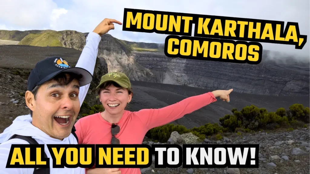
When we think of islands in the Indian Ocean, the images that usually come to mind involve luxury resorts in the Maldives, the idyllic beaches of Mauritius, or the pristine atolls of the Seychelles. However, there is a small, extraordinarily fascinating archipelago almost forgotten by mass tourism that hides one of the planet’s greatest volcanic adventures: the Comoro Islands.
Located in the Mozambique Channel between the coast of East Africa and northern Madagascar, Comoros is home to the majestic Mount Karthala (or Monte Karthala). Rising to an elevation of 2,361 meters (7,746 feet), it is the highest point in the country and one of the world’s most impressive active volcanoes, boasting one of the largest active volcanic calderas on Earth.
Climbing Mount Karthala is a truly epic experience, but it requires physical fitness, careful planning, and an adventurous spirit—especially if you decide to tackle the ascent independently and without a local guide. In this complete guide, I will share in detail what my journey up the volcano was like, the step-by-step route, the navigation challenges, and all the practical tips you need to know to make this unforgettable hike!
Or watch my climb on Youtube:
What Is Mount Karthala and Why Take On the Challenge?
Mount Karthala forms the massive spine of Grande Comore (Njazidja), the largest island in the Comoros archipelago. As a massive shield volcano, its historical eruptions have shaped much of the island’s geography, soil, and topography over the centuries. To put its power into perspective, Karthala has had more than 20 recorded eruptions since the 19th century, with the most recent occurring in 2005 and 2006, which spewed ash across the capital city of Moroni and dramatically altered the internal structure of its huge crater.
The hike to the summit is famous for offering a drastic change in ecosystems within just a few hours of walking. You start the trek trekking through dense, humid tropical rainforests filled with native flora and endemic birds, and as you gain elevation, the forest gives way to an almost lunar landscape dominated by dark basaltic rock, steaming sulfur vents, and a profound silence.
The ultimate reward at the top is reaching the rim of the main crater—a massive abyss miles in diameter that makes you feel incredibly tiny against the living power of our planet.
Can You Climb Mount Karthala Without a Guide?
This is one of the most frequent questions among backpackers and independent travelers visiting Comoros. The short answer is: yes, it is possible to climb independently, but with important caveats.
Unlike heavily structured national parks in Europe or North America, Mount Karthala has no official ticket booths, ranger stations, or clear trail signs along the way. The paths were created by the movement of local villagers and farmers, branching off multiple times within the dense vegetation of the rainforest.
The Challenges of an Independent Ascent
- Lack of Trail Signs: There are no signposts, painted trail markers on rocks, or directional wooden poles. Without a reliable offline GPS navigation app (such as Maps.me or Wikiloc with the regional map downloaded in advance), the risk of taking a wrong turn at forest junctions is high.
- Rapid Weather Changes: Mountain weather shifts in minutes. Dense fog (known as mountain mist) can roll in during the afternoon, reducing visibility down to a few feet.
- Demanding Terrain: The climb is continuous and steep, demanding solid cardiovascular fitness and leg strength to navigate mud, slippery roots, and loose volcanic scree.
If you have prior trekking experience, know how to use offline GPS maps accurately, and are in good physical shape, completing the trek independently is entirely doable and provides a unique sense of freedom and accomplishment. Otherwise, hiring a local guide in Moroni or at the base villages is a fantastic way to support the local community economy and ensure a stress-free hike.
How to Get to the Trailhead (Starting Point)
Most expeditions to Mount Karthala start either from the capital, Moroni, or from villages nestled along the mountain slopes, such as Mvouni or Mitsoudjé.
Transport Options to the Base
- Private or Hired Taxi: The most convenient way to start early in the morning is to negotiate in advance with a taxi driver in Moroni to drop you off at the highest point accessible by road in Mvouni village (near the university campus) or along the mountain access road. Make sure to also arrange a pickup time and price for the late afternoon.
- Shared Taxi (Taxi-Brousse): For budget travelers, you can catch a shared local taxi from central Moroni heading toward the base villages. However, these taxis start running a bit later in the morning and will drop you off at the lower part of the village, adding a few extra kilometers of uphill walking before you even hit the main trail.
Pro Tip: Start your hike as early as possible, ideally between 5:00 AM and 6:00 AM. Setting off at dawn is crucial to avoid the stifling heat of the tropical forest during the first few hours and to ensure you reach the summit before afternoon clouds roll in and obscure the panoramic view of the crater.
Step-by-Step Trail Guide: From Rainforest to Lunar Landscape
The total round-trip hike up Mount Karthala typically covers between 20 to 25 kilometers (12 to 15 miles), depending on your exact starting and ending points, with an elevation gain exceeding 1,600 vertical meters (5,250 feet).
Stage 1: The Dense Tropical Rainforest
The first few kilometers cut through agricultural plots and Grande Comore’s dense, humid tropical forest. Here, the climate is hot and muggy. The trail climbs steadily past giant trees, towering ferns, and lush tropical foliage. The ground in this section consists of rich dark soil and exposed tree roots that can be very slippery, especially if it rained the night before.
During this section, pay close attention to your GPS navigation app, as there are numerous secondary paths cleared by locals collecting firewood or tending crops.
Stage 2: The Transition Zone and Mountain Ridge
As you push past 1,500 meters (4,900 feet) above sea level, the scenery transforms dramatically. The tall trees give way to low shrubs, mosses, and sparser high-altitude vegetation. The air becomes noticeably cooler and crisper, providing a welcome relief from the heat below.
In this mid-section, on clear days, you can look back to catch breathtaking panoramic views of Moroni, the jagged coastline, and the deep blue expanse of the Indian Ocean. It is also around this altitude that mountain mist often begins to swirl, giving the landscape a mysterious atmosphere.
Stage 3: The High Plateau and Volcanic Crater Rim
During the final kilometers leading to the summit, vegetation vanishes almost completely, replaced by a fascinating volcanic desert. The ground beneath your feet transitions to ash, pumice, and jagged fields of black basaltic lava.
The final stretch demands a renewed physical effort to push through the loose volcanic scree. However, once you step onto the rim of the main crater, all fatigue instantly vanishes. The sight of Karthala’s caldera is vast and awe-inspiring: a giant vertical rock wall dropping hundreds of feet down to a flat floor of petrified lava, where sulfur plumes and secondary volcanic vents continuously steam.
Essential Practical Tips for Trekking Mount Karthala
To ensure your adventure is safe, comfortable, and memorable, here is a practical checklist of everything you need to consider before hitting the trail:
1. Water and Supplies (Total Self-Sufficiency)
There are no reliable drinking water sources, shops, or mountain huts along the entire route. You must be 100% self-sufficient:
- Water: Carry at least 3 to 4 liters (1 gallon) of water per person. Dehydration is a major risk due to the intense physical exertion combined with initial tropical humidity.
- Food: Pack high-calorie, easily digestible snacks such as nuts, protein bars, dried fruit, chocolates, and a solid lunch to enjoy at the summit.
2. Proper Gear and Clothing
The most common mistake travelers make is preparing only for the tropical heat at sea level and forgetting that the volcano summit can be cold, windy, and exposed:
- Footwear: Wear sturdy hiking boots or trail running shoes with aggressive tread and good grip. Avoid casual sneakers or worn-out shoes.
- Layering System: Wear light, breathable clothing for the forest climb, but pack a windproof/waterproof jacket, a thermal base layer or fleece, and rain gear in your pack. The wind along the crater rim can be freezing.
- Headlamps: Essential if you plan to start climbing before dawn or in case your descent takes longer than expected and finishes after dark.
- Trekking Poles: Highly recommended to save your knees during the long, punishing descent over loose volcanic rock.
3. Best Time of Year to Climb
The best time to trek Mount Karthala coincides with the dry season in Comoros, which runs from May to October. During these months, temperatures are cooler, rainfall is significantly lower, and the trails are less muddy and much safer.
Between November and April (the rainy and cyclone season), tropical downpours are frequent, making the trail extremely slippery, hazardous, and offering little to no visibility at the crater.
4. Battery Life and Offline Navigation
Make sure to fully charge your smartphone the night before and bring a Powerbank (external battery). Because your GPS will be actively running throughout the day to track your route, battery consumption will be high. Download the map of Grande Comore Island on Maps.me or Wikiloc before leaving your hotel.
Final Thoughts: Is Climbing the Volcano Worth It?
Conquering Mount Karthala independently without a guide is one of the most authentic, raw, and wild trekking experiences you can have in Africa and the Indian Ocean islands. The feeling of starting near sea level, trekking through untouched rainforests, and standing on the edge of one of the world’s most active and impressive volcanoes brings an indescribable sense of accomplishment.
If you are planning a trip to the Comoro Islands and seeking an off-the-beaten-path adventure, place the Karthala trek right at the top of your itinerary. With proper physical preparation, the right gear, and careful navigation, this journey will easily become one of the highlights of your travel life!